Pilgrimage sites, which first spread across the Italian regions in the 16th century, were called Sacro Monte (Sacred Mountain). The name suggests that the churches and chapels people visited were situated on hills and elevations rising above the surrounding landscape. Many pilgrimage sites within the Slovenian ethnic territory and beyond also include the word “mountain” in their names or otherwise denote their location above the surrounding area (e.g., Stara Gora near Cividale, Sveta Gora near Gorizia, Ptujska Gora, Svete Višarje, Međugorje, Montserrat).
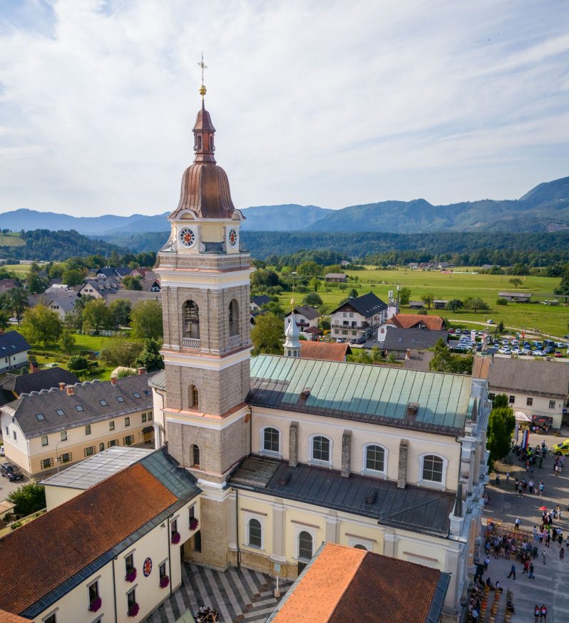
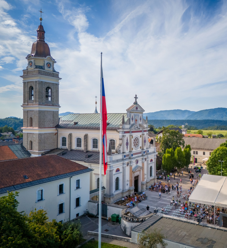
At first glance, the central Slovenian Way of the Lord to Mary Help of Christians in Brezje does not suggest that it was necessary to climb uphill to reach the Basilica. This impression is somewhat misleading, especially from today’s perspective, when modern road links, with viaducts and tunnels, save the uphill or downhill journey. But what about in the past, in the days when people and authorities did not argue about where the motorway should go? Those who made the pilgrimage to Brezje on foot or by bicycle, coming from the direction of Kranj, via Posavec, descended down into the valley of the Peračica stream just before Brezje, crossing it at an altitude of about 390 metres above sea level. From the bridge, they had to climb first to Dobro Polje and then to the Brezje field to the basilica. They had to climb nearly 100 metres. The access from the east, from Dežela, is slightly more difficult, with no such differences in altitude.
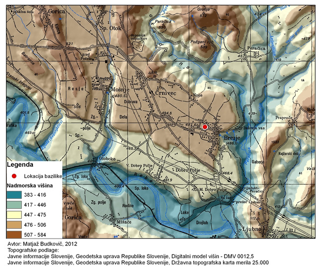
Let’s take a brief look at how the land around Brezje has been shaped. The surface in this part of the Ljubljana basin took its final shape during the last glaciation. The rivers deposited thick deposits of gravel and sand in the Ljubljana basin, which were re-cut during the interglacial periods to form the terraced valleys. The pebbles, together with smaller particles, later coalesced into conglomerate. The Brezjansko polje is a remnant of the former highest terrace of the Sava. The Peračica stream cut its channel into these deposits in the east and north, the Sava river in the south and the Dobruša stream in the west. The Brezjansko polje is thus surrounded on all sides by valleys.
The image of the Brezje field as an outcrop above the surrounding landscape is also clearly visible from the attached map.
(writes: Matjaž Geršič)
To ensure the best experience, we use cookies to store and/or access device information. Consent to these technologies will allow us to process data such as browsing behavior or unique IDs on this website. Refusal or withdrawal of consent may adversely affect certain capabilities and functions.